![]()
1.1 GeographyZanskar together with the better known region of Ladakh were once known as Little or Western Tibet. These two ancient Buddhist kingdoms now belong to the state of Jammu and Kashmir in northwestern India. ( Fig 1.3 and Fig 1.10 ) Zanskar covers an area of some 7000 km2 at an elevation between 3500 and 7000 meters. It comprises the country lying along the two main tributaries of the Zanskar river. The first one, the Doda, has its source near the Pensi-La (4400m.) mountain-pass and then flows south-eastwards along the main valley leading towards Padum, the capital of Zanskar. The second branch is formed by two main tributaries known as Kurgiakh-chu with its source near the Shingo-La and Tsarap-chu with its source near the Baralacha-La. These two rivers unite below the village of Purne to form the Lungnak river (also named Lingti or Tsarap). The Lungnak-Chu then flows north-westwards along a narrow and precipitous gorge towards the Padum Valley where it unites with the Doda river to form the Zanskar river. The Zanskar river then takes globally a north-eastern course until it joins the Indus river in Ladakh. High mountain ridges lie on both sides of the NW-SE trending Doda and Lingti/Kurgiakh valleys.To the southwest is the Great Himalayan Range that separates Zanskar from the Kisthwar and Chamba basins. To the northeast lies the Zanskar Range separating Zanskar from Ladakh. Thus, the only outlet for the whole Zanskar hydrographic system is the Zanskar river which cuts a deep and narrow gorge through the Zanskar range. |
 |
These topographical features explain why access to Zanskar is difficult from all sides. Communication with the neighbouring Himalayan areas is maintained across mountain passes or along the Zanskar river when frozen. The easiest approach leads from Kargil through the Suru Valley and over the Pensi La. It is along this track that in 1979 the first and only road in Zanskar was built to connect Padum with the main road from Srinagar into Ladakh. The remoteness of this region also explains why only a few western travellers have visited this area until recent times, the tibetologist Alexander Csoma de Koros in 1823 being probably one of the first. Moreover, because of the recent border conflicts between India and Pakistan or China, Zanskar was declared a restricted area and was reopened to foreigners only in 1974.
|
|
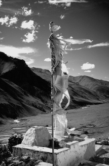
| Fig 1.2: Prayer flag above the monastery (Gompa) of Tanze, in the Kurgiakh valley. The wind is believed to propagate the prayers printed on tissue. | ||
|
|
previous page "Introduction" | next page "Climate and population" |
©Pierre Dèzes